Australia has encountered many cyclones throughout the past century. However, there are areas in Australia which have been far more seriously affected by them, compared to other areas. The general areas of Australia which have been most seriously affected by cyclones are:
"Seventy-two of the total of 146 coastal crossings in Australia between 1970-71 and 2003-04 were in WA. Thirty-four of the total 42 severe cyclone crossings occurred in WA and most of these occurred between Broome and Exmouth. In WA this equates to 2.2 cyclone crossings per year, one of which is severe on average". A trend among these frequent occurrence is an indication that the affected areas are mainly towards the north of Australia. Within the regions of Australia, the official tropical cyclone season runs from November to April, with peak numbers between December and April. Approximately 10 cyclones develop over Australian waters annually and an estimate of 6 of these cross the coast. |
Maps of Cyclone Paths and Areas Most Seriously Affected
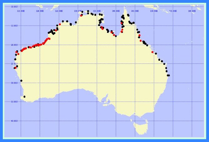 | Tropical cyclone crossings in Australia 1970-71 to 2001-02. The black dots represent non-severe cyclone crossings and red dots severe cyclone crossings. |
Map showing average annual frequency of tropical cyclones in the Australian region. | 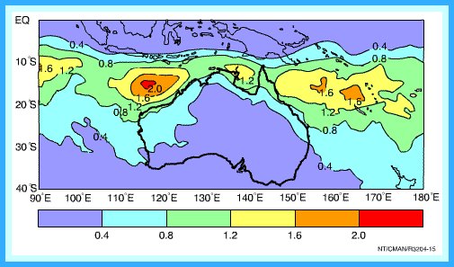 |
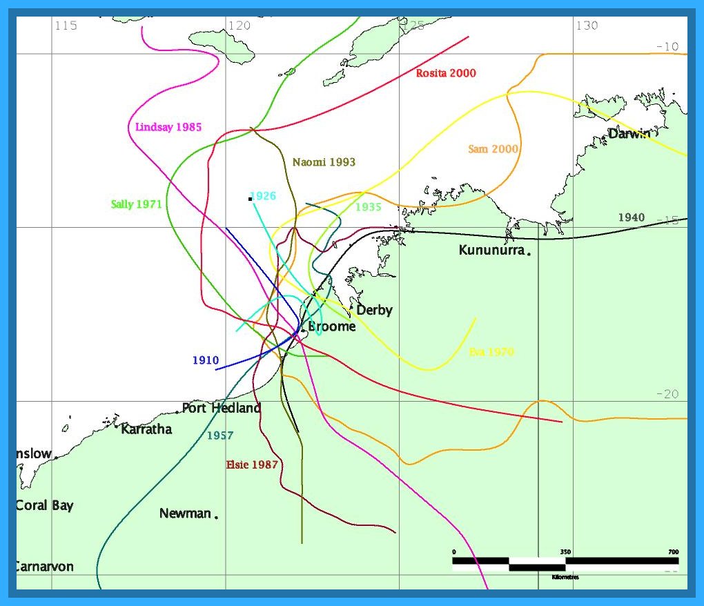 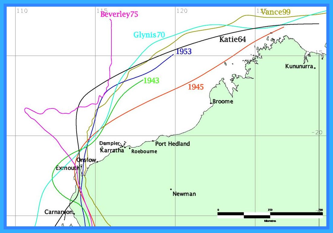 | Tracks of notable cyclones affecting Broome, Western Australia Tracks of notable cyclones affecting the Exmouth region, Western Australia |
Tropical cyclone tracks for cyclones that formed or moved through the Eastern region from 1970 - 2004 including central and northern coasts of Queensland | .png) |
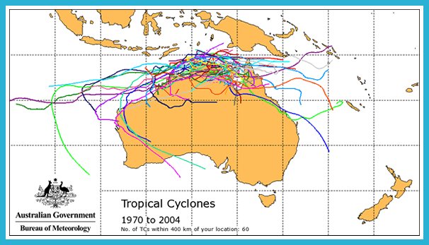 | Tropical cyclone tracks for cyclones that formed or moved through the Northern region from 1970 - 2004 including coastal regions of Northern Territory |
All photos courtesy of the Australian Bureau of Meteorology